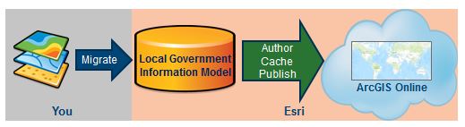
One of the most common questions potential Community Maps contributors ask is “How long will it take to see my map layers in the World Topographic Map after I submit them”? While there are many factors that can influence the time it takes to publish contributed map layers, the best way to ensure faster processing is to use the Local Government Information Model for data contributions.
The Local Government Information Model is a comprehensive geodatabase schema that includes foundation layers and operational information that support a range of key maps and apps within a local government. This data model is used by Esri Community Maps to support the authoring of the World Topographic Map and other ArcGIS Online basemaps. The Local Government Information Model is a perfect fit for Community Maps because the schema contains all of the basemap layers and attributes that are relevant to our quality online basemap products.
When Community Maps contributors provide their map data in a file geodatabase that conforms to the Local Government Information Model, it significantly decreases the amount of processing that is required to author the basemap and finalize the contribution. This typically results in a much faster publishing time than if the data is provided in a non-conforming schema.
Data that is in the Local Government Information Model schema is published more quickly.
Many Community Maps contributors have already adopted the Local Government Information Model as their primary geodatabase schema, so their Community Maps data submissions automatically conform to the preferred model. For those contributors who are using a different data model, however, this means having to prepare their basemap data layers for the new schema. At first this can seem daunting, particularly since the Local Government Information Model is so comprehensive (275 possible feature classes). However, when you examine it more closely you see that less than 20 feature classes are relevant to Community Maps, and most organizations will only be contributing a subset of those. Ultimately, the data preparation process usually ends up involving just a handful of layers and attributes.

Local Government Information Model feature classes that are relevant to Community Maps
To make the migration to the Local Government Information Model as smooth as possible for contributors, the Community Maps team has developed several resources, including online documentation, ArcUser tutorials, an explanatory story map and a free online instructor-led workshop. We will continue to add to these resources and would love to hear from you what type of assistance would be most helpful. If you have ideas, please send them to communitymapstraining@esri.com.
So remember, if you are looking for the best way to expedite the publishing of your Community Maps data contribution to the ArcGIS Online basemaps, make sure to use the Local Government Information Model schema when you submit it.